


Nautical Charts — OsmAnd

Nautical Charts — OsmAnd leírása
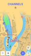
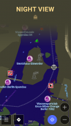
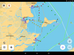
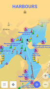
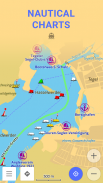
Hajózási térképek - OsmAnd egy kiterjesztés OsmAnd Térképek és navigáció app, amely szabad hajózási térképek offline használatra. Ez a tengeri térkép lesz a megbízható társ, hogy megy a halászati, illetve tervez egy tengeri utazás.
Vízi diagramok részletes grafikus ábrázolása az óceánok, tengerek, a parti területeket, és a folyók. A diagramok tartalmazhat különböző információkat, mint a hajózási útvonalakat, a navigációs fények, veszélyes területek, ahol ez engedélyezett vagy nem engedélyezett vitorlázni vagy dokkoló, stb
Ezek a térképek is kiegészített információt a mélységvonalak és hajózási mélység pontokat hozzá értékes adatrétegeinket a térképet.
Minden szakmai hajósok is kötelesek hivatalos tengeri térképek
hajóikon. Ezek a térképek által közzétett hivatalos szervek és a költség elég sok pénzt. Ügynökségek fektetnek egy csomó tartja a grafikonok naprakész. Ők adnak ki frissítéseket a listákon rendszeresen, hanem azért, mert az a tény, hogy felülvizsgálja az információ és feldolgozzuk a frissítések bizonyos időtartamot vesz igénybe, a hajózási térképek soha nem teljesen up-to-date.
Hajózási térképek által OsmAnd alapulnak az adatokat a OpenSeaMap projekt. Az az elképzelés, a projekt célja, hogy létrejöjjön a részletes térkép az emberek, akik ténylegesen használják. Minden felhasználó a térkép hozzájárulhat hozzáadásával változtatásokat így részletesebb és pontosabb.
Míg OpenSeaMap grafikonok abban a pillanatban nem tud versenyezni a hivatalos hajózási térképek, fel lehet használni a szabadidős vitorlázók számára irányultság vagy útvonaltervezés. Ez a bővítmény nem nyújt hajózási navigációs de ez az offline referencia eszköz, amely együtt használható más navigációs programok.
Használati utasítás: erősen ajánlott letölteni hajózási alaptérkép érdekében, hogy a térképek függetlenül részletes térkép jelenlétét. Hajózási térképek állnak rendelkezésre, mint egy térképet és egy speciális stílust, hogy váltani stílus OsmAnd használja a menüpont „Beállítás Map” a térkép képernyőn.


